
I used 360 Panorama app to shoot the preceding geotagged panorama photo of Milway Meadows, a residential community in Fairfax County, Virginia. The same panorama photo was uploaded via Posterous app (shown below); most of the EXIF/IPTC info, including GPS Info, is missing due to a bug in Posterous app for iOS. An online interactive version of the photo simulates virtual reality, enabling you to see what I saw! Can you see where the panorama came full circle? Let’s hope the developers at Occipital are able to figure out a clever solution for this glaring problem.
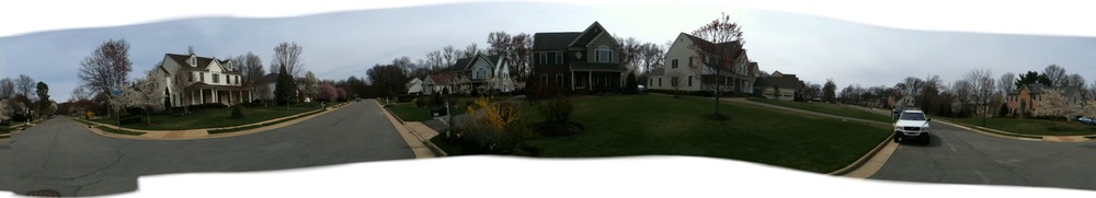
Contrast the 360 Panorama app photo with the same scene shot using AutoStitch Panorama app.
Tags: 360 Panorama, Apple iPhone, AutoStitch Panorama, digital photography, EXIF, geotagging, IPTC

Leave a comment